Deans Mill History

Lindfield’s River Ouse and Deans Mill - Part 1

By Richard Bryant, Lindfield History Project Group

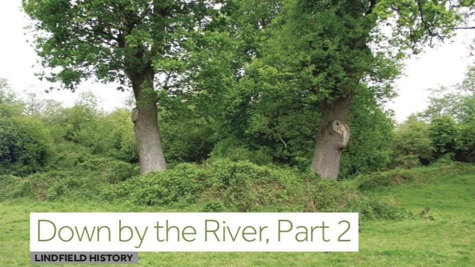
When did you last stand on Lindfield Bridge and look at the river? It is quite easy when driving from Lindfield towards Ardingly not to notice you cross a bridge over the Ouse, as only the briefest glimpse of the river is possible. The dark, slow flowing water passes through private land with no public access, perhaps making it Lindfield’s hidden and forgotten river.

The Ouse is 33 miles long and flows south in a gentle curve. Starting as a trickle near Lower Beeding it gains strength from a spring at Slaugham, and further small tributaries join as it journeys towards Upper Rylands Bridge (by the Balcombe viaduct). By the time it flows
to the north of Lindfield it has grown into a river. The Scrase Stream that meanders through Lindfield joins beyond East Mascalls. The Ouse continues on its curving journey passing through Lewes and onward to the sea. Until medieval times it entered the sea at Seaford, but, due to silting up, the mouth became inaccessible to the larger ships being built at that time. In 1539 a man-made cut was made to take the river directly to the sea, with the new exit being named Newhaven, allowing ships to access Lewes. From Lewes to the sea the river was known as ‘The Great River of Lewes’ then pronounced Looze, from which the name Ouse is derived. The river upstream from Lewes was known as the Middewinde (various spellings) meaning middle. The last evidence for this name being formally in use was some hundred years ago when Midwyn Bridge was renamed Lindfield Bridge. The current bridge dates from 1938.

Throughout history the river has been a route for small craft to journey into the heart of mid Sussex. Thomas Pelham of Stanmer Park, MP for Sussex, arranged in 1787, at the height of canal mania, for William Jessop to undertake a survey to see if the river could be made avigable for barges from Lewes to Slaugham. Jessop’s report suggested the river be ‘canalised’, that is straightened, widened and deepened, from Lewes to Pilstye Bridge (on the Cuckfield- Balcombe road). The estimated cost was £13,595. The Upper Ouse Navigation Act passed through Parliament in 1790, creating The Company of Proprietors of the River Ouse. A contract for construction at the cost of £15,199 was signed and work started with a completion date scheduled for May 1792. Work did not go to plan and the builders were replaced in 1802. It was not until 1809 that 30 tonne barges, measuring 50ft long, could reach Pim’s Lock at Lindfield. From the passing of the Act, it had taken 19 years to complete 19 miles with 15 locks. The decision was then made to terminate the navigation at Upper Rylands Bridge (the hump back bridge by the Balcombe viaduct). This final section opened on 22nd April 1812, required four locks and a small basin for the barges to turn in, which has long been filled in, but the wharf cottages remain to this day.

The total cost was massively more than the original estimates. Tolls never reached the expected levels and, to make matters worse, the clerk responsible for managing the toll money was accused of misappropriating the money over a ten year period.

The main cargos were wood, chalk, marle and coal, charged by the tonne per mile. Trade gradually improved and in the 1830s the canal company secured a contract from the London Brighton & South Coast Railway to transport the building materials to build the viaduct
at Balcombe. The coming of the railways signalled the terminal decline of the Ouse Navigation and the company closed in 1859.

A trade reliant on the river that lasted significantly longer was milling, with many mills being built on the river above Lewes. From the eighth century, land in and around Lindfield was controlled by the Canons of South Malling, with their Dean holding the land adjacent to today’s Lindfield Bridge. A short distance downstream, the Dean was responsible for building a water powered mill on the banks of the river, hence the name Dean’s Mill. A mill has existed on this site for over a thousand years. After the dissolution of religious houses by Henry VIII in the mid-1500s the mill passed into secular ownership. Following changing owners several times, it was acquired in the 1700s by the Pim family and a new mill was built in 1761. For a time their mill was both a corn and paper mill with both trades continuing to about 1850 when paper making ceased.

By 1858 the Pim family had left, and the mill was next occupied by Robert Jenner and his son, Samuel. In 1880 a new mill, which stands to this day, had to be built as the Pim’s mill building was virtually destroyed by a severe storm. The milling continued, with a succession of millers, until around 1930.

Dean’s Mill was bought by Mr and Mrs Horsfield in 1935 and milling recommenced, and, with a change in ownership in 1957, production of stoneground flour continued until 1976 when all milling ceased. The mill is now a private residence.

Shortly after acquiring the mill, Mr Horsfield diversified the business by converting the Elizabethan barn that stood in the grounds into a tea room and constructed a narrow gauge railway, Dean’s Mill Railway, as a visitor attraction. The railway opened in 1937 and comprised some three hundred yards of track with cuttings, a short tunnel and station platform. Passengers travelled in an open carriage fitted with rows of bench seats, initially pulled by a small steam tank locomotive but this was soon replaced. Service was suspended during the war and recommenced with a petrol powered locomotive. The railway remained popular until its closure in 1957 following the mill’s change in ownership. A Lindfield Life reader, Ron Batchelor, fondly remembers ‘it was a real treat to be taken by my parents on a Sunday afternoon to Dean’s Mill for a ride on the little railway with tea afterwards’. A memory no doubt shared by many youngsters in the decade after the war.

Find Part 2 of Down by the River here.


Lindfield’s River Ouse, Deans Mill - Part 2

Part 1 can be found here

By Richard Bryant, Lindfield History Project Group

Last month’s article (found in Lindfield History Articles December 2018) looked at the River Ouse and Deans Mill, this month’s explores more nearby features along the river.

Did you know Lindfield has a castle? If Historic England’s Monuments Schedule is to be believed, on the northern bank some 500m downstream from Lindfield Bridge, on strictly private land, stand the remains of earth works described as a motte and bailey, dating to Norman times. Named Lindfield Castle it is also marked on Ordnance Survey maps as a motte and bailey, although all that remains today are a series of bumps covered by bushes and trees. Historic England’s record says the motte at the centre measures about 40m across and stands some 1.5m high. This was surrounded by a broad moat which joined to the river through gaps in the outer earthworks. North-west of the motte is a crescent shaped bailey 45m long. Outside a ditch linked to a stream entirely surrounded the castle. Such defensive structures were constructed in towns and on open land. The listing describes its position as ‘strong yet strategic location for policing of traffic crossing the Ouse’. However their papers do indicate an element of doubt as to its origin and suggest it might have been a system of fish ponds. This is plausible as in 1175 a nunnery was established somewhere close to the castle site. Fish ponds were a feature of religious houses in medieval times. Another suggestion is the remains of a moated farmhouse.

Interestingly, on the 1845 Tithe Map, the earthworks are labelled ‘site of a priory’. The adjoining two fields carried the names Nunnery Pond and Nunnery Plot, while standing close by is a wood which to this day is called Nunnery Wood. This small nunnery was no doubt closed on the orders of Henry VIII and quickly became a ruin. Since that time all traces of the stonework have disappeared.

As an aside, hanging on the wall in the Library Room, King Edward Hall is a copy 1840s map. Although difficult to see, in the top right hand corner is a small drawing that purports to show ‘The Ruins of Lindfield Nunnery as they appeared in 1601’ with a pond in the foreground. Without an archaeological survey the precise location of the nunnery and the true origin of the earthworks will remain undiscovered, but it is pleasing to think Lindfield might have had a Norman castle. A fact beyond doubt is that the Ouse did have an important strategic defensive role during World War Two. Early in the war, in the event of a German invasion breaching the Sussex coastal defences, ‘stop lines’ were created along natural features to halt or at least slow any advance. One of the most important lines ran west to east along the Rivers Arun and Ouse with an anti-tank ditch joining them between Handcross and Slaugham.

The northern riverbank at Lindfield was revetted with vertical tree trunks making it difficult for tanks to mount the bank, so forcing them towards Lindfield Bridge which was heavily defended with anti-tank blocks, barbed wire and a pillbox. It was the responsibility of the Lindfield Home Guard to man this Type 28 pillbox, which still exists today just north of the bridge. There were similar defensive positions at the other local bridges. Home Guard member Sid Cross recounted several years ago being equipped with a Lee Enfield rifle and ten rounds of ammunition and told ‘that was enough to kill 12 of the enemy – ten with bullets, one with the bayonet and the last with the rifle butt’. An anti-tank gun was not received until later in the war. Thankfully, the invasion threat soon receded! A short distance along the road is the southern entrance to Paxhill, which during the war was a Canadian Army camp.

There were similar invasion fears in the mid-19th century arising from the French, resulting in the Sussex Rifle Volunteer Corps being formed to defend the county. It was essential for these part-time soldiers to be able to shoot accurately. For 25 years, the men of the Lindfield unit had ‘been subjected to the inconvenience of having to walk to Cuckfield for target practice’. To correct this unsatisfactory situation, Colonel Dudley Sampson, the owner of Buxshalls, made land available upstream of Lindfield Bridge for use as a firing range. In August 1886, the 300 yard range was opened with much ceremony and a mock battle defending a nearby foot bridge. Two years later the range was extended to 600 yards and it was hoped this facility would encourage more Lindfield men to join the volunteers.

A more peaceful pursuit, also on Buxshalls Estate’s land, was established about 200m upstream from Lindfield Bridge, when in May 1906 the Lindfield Swimming Club was formed. Colonel Dudley Sampson agreed to grant the club permission to use a section of his riverbank, provided everything was conducted in a proper manner and all non-costumed bathers treated as trespassers. Accordingly, club rules were established, and approved by the Colonel, prohibiting card playing, gambling and other improper conduct and requiring all bathers to wear full ‘University costumes’ in the club’s colour of navy blue. From the annual subscription rates it would appear membership was initially only open to men and boys.

The bathing place, as it was known, was soon set up with a changing hut and the land fenced off. Arrangements were made with the miller at Dean’s Mill to shut the sluice gates during Friday evenings to allow water to build up for the weekend. This allowed members to dive from low boards.

The club thrived, women were permitted to join and facilities constantly improved including men’s and women’s changing huts; a newspaper report also mentions a ‘clubhouse’. In 1924 the club had 229 members made up of 156 gentlemen and 73 ladies. It was decided to construct a new diving stage spanning the river, with platforms at 6ft, 10ft, 14ft and 18ft, and room ‘for ten persons to dive off the stage at once’. Permission was given to deepen the centre of the river to allow safe diving from the new higher top platform. Arrangements to blast the riverbed were duly made!

Swimming galas and diving competitions were regularly arranged for members and matches against other local clubs, with cups and medals duly awarded. The bathing place provided much enjoyment for villagers and many children learnt to swim and dive in the river. Sadly the facility was closed in 1938 due to a polio scare in Lindfield.

On this section of the Ouse, historic records for the 1500s and 1600s suggest a fulling mill stood, unfortunately little information is available, although its one time existence appears to be reflected in the names of the nearby farm and derelict river lock. Finally, adjacent to Lindfield Bridge, for many years during the 19th century, was a wharf, mainly for coal carried up the river from Lewes. The facility to transport coal in bulk by barge allowed Lindfield residents to enjoy cheaper coal and increased its usage in the village.